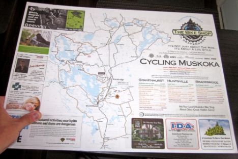
This custom cycling route map was developed using satellite imagery to manually create the base vector when plotting the locations of the lakes and roads. A relatively large, 2-sided piece, this project displays road cycling routes on one side and the mountain biking trails for both Buckwallow and Porcupine Ridge on the reverse side. The clients offset the cost of development by offering sponsorship positions around the map artwork. The maps were padded in 50's and printed on an offset-bond stock to allow for ease of writing on the piece should any notes or locations need to be marked.